
01/03/2020
Had a lazy start to the day before donning our walking shoes around midday and following the walking track to 'The Snout' which is the northern headland for Waikawa Bay. It was a hot, still day with Queen Charlotte Sound looking wonderful from the several viewpoints along the way. The walkway undulates quite a lot with some sections rather steep, so after roughly ten kilometres and three and a half hours we were glad to be back at our motorhome with plenty of cold drinks.


Day twenty seven.
Travelled the short distance from Picton through Waikawa to Whatamango Bay DOC campsite. A pleasant outlook but quite a tidal bay. We are waiting for the northerly winds and showers to ease before we journey to the outer Marlborough Sounds.


Day twenty eight.
A day for reprovisioning and preparation today. Freshwater, fuel and groceries onboard we were ready to make our way to the outer Marlborough Sounds but for the strong winds blowing. Instead we decided to stay put in Blenheim at Taylor Dam with the strong winds forecast to reduce over night. Taylor Dam is situated about two kilometres beyond the southern outskirts of Blenheim. It is the site of New Zealand's largest earth flood protection dam, comissioned in 1965 to prevent the Taylor River flooding Blenheim. A small lake has formed behind the dam supporting a large variety of water birds and the whole area is an attractive public reserve with picnic areas, walking and mountain bike tracks.


We got well acquainted with a very tame and inquisitive Pukeko which we were able to touch and stroke while it tried to relieve us of our keys.


Day twenty nine.
The wind had dropped this morning but only a little and had reversed direction so we set off for Havelock with a tail wind. As we proceeded to Linkwater we had a dramatic view down Pelorous Sound with a forboding sky.

After twenty eight kilometres along the narrow winding Kenepuru road we arrived at Cowshed Bay, our destination for the night. Under a cloudy sky the wind was strong and gusty from the south, peeling spray from the surface of the bay. Conditions not very conducive for much but a quiet afternoon inside.

Surprisingly we have cellphone and internet reception in this remote part of New Zealand allowing us to update our blog.
Day thirty.
Not much to report today.
The weather has improved, although the wind is still fresh and it has been partly cloudy. Tomorrow's forecast is better and improving, raising our hopes of some typical late Summer Marlborough Sounds weather.
We have moved to Keneperu Head DOC campsite, parked overlooking Keneperu Sound which is rather tidal here making it ideal for large numbers of wading and water birds. A pleasant view none the less and perfect for watching the sunset.


Day thirty one.
We set off, shortly after breakfast, on our way to Waimaru DOC campsite on the northern shore of Clova Bay. This was quite a journey along a narrow, winding road, particularly so from Waitaria Bay where it turned to gravel and became rough. Surprisingly the road was largely sealed to Waitaria Bay with a road crew we passed in the process of sealing the remaining gravel section.


The campsite is a small area of grass, not much of it flat, with mixed native and exotic trees and shrubs described as being near the waters edge. However, due to changing land ownership and relocation of the campsite, it is a three hundred metre walk to the waters edge. The view from our parking place was expansive, taking in a large area of Pelorus Sound and it's bays. Very lovely, but was it worth the effort?

Short walks along the beach and road as well as fishing were our activities for the afternoon with the persistent fresh wind hampering my first attempts at salt water fly fishing. However the Kahawai were willing and although my first success wasn't too impressive, the ones that followed were larger.

Day thirty two.
Simple today.
Still at Waimaru.
Walked, fished and enjoyed the sun.

Day thirty three.
Left Clova Bay and Waimaru this morning driving carefully on the rough winding gravel road back to Waitaria Bay where we came across a small red cottage, apparently being restored. Yes it was that red!

Carrying on we passed close by one of the Green Lip Mussel aquaculture farms of which there are surprisingly many.

Once we reached Keneperu Head we carried on up the Titirangi Road to Keneperu Saddle. We parked our motorhome and walked the last kilometre down the Endeavour Inlet side to Punga Cove Resort. There at the Cafe we enjoyed coffee, ginger beer and triple chocolate brownies sitting on the jetty in the sun before trudging back up the hill. The brownies were devine and worth returning for on their own.


Back on the road again we had our sights set on Nikau Cove DOC campsite hoping there would be room at this small campsite. There was, so we settled in for the afternoon and evening right on the beach looking out on Keneperu Sound.


Day thirty four.
We have left Pelorus Sound and it's associated waterways, at least for the meantime. Around midday we parked ourselves at Aussie Bay DOC campsite situated close to the head of Queen Charlotte Sound. Quietly passed the afternoon away with a walk to Momorangi Bay and back plus a swim in Queen Charlotte Sound to cool off.
Aussie Bay is a quiet, pretty bay by day and a ridiculously overcrowded campsite by night.


Day thirty five.
Today dawned sunny and still on Queen Charlotte Sound, a typical Marlborough Sounds day.

With nothing more than reprovisioning and chores planned for the day we walked from Aussie Bay to The Grove jetty along the excellent walking track and cycleway being constructed between Picton and Havelock. A Stingray, quite common in the Sounds, cruised under the jetty in the clear water while we were there.


On our way to Havelock Holiday Park campground we took a brief walk to the lookout above Cullen Point from where we could look both back down Pelorus Sound to Mahau Sound and to Havelock in the other direction.


We have been studying the weather forecast in planning for our next adventures.
Day thirty six.
A day marking time today. We drove to Canvastown early in the morning and while Sara relaxed with a book, I went fishing in the Wakamarina River which joins the Pelorus River there. Canvastown got it's name from the tent town that sprang up initially after the discovery of gold in the Wakamarina Valley in 1864.
Parked in the Trout Hotel carpark for the night, we spent the evening in the Pub enjoying a great atmosphere, good pub meals and of course a drink or two.
Incidentally, the Trout Hotel, the second hotel on this site, built in 1903, is for sale. Just imagine that, you could own your own pub.

Day thirty seven.
Today as forecast was fine with light winds which was just what we wanted for our excursion on the Pelorus Sound Mail Boat.

On this trip tourist passengers get to experience the daily mail and freight delivery and pickup service for residents of the outer Pelorus Sound waterways not serviced by roads. This is the only genuine mail boat service still running in New Zealand. Put out to public tender by the New Zealand Government in 1918, it still provides the same services today.

We called in at the historic Wilson Bay Farm established in 1881 and still farmed by the same family five generations later. We were treated to an informal presentation about their farming of Romney breed sheep in the harsh outer Sounds conditions.


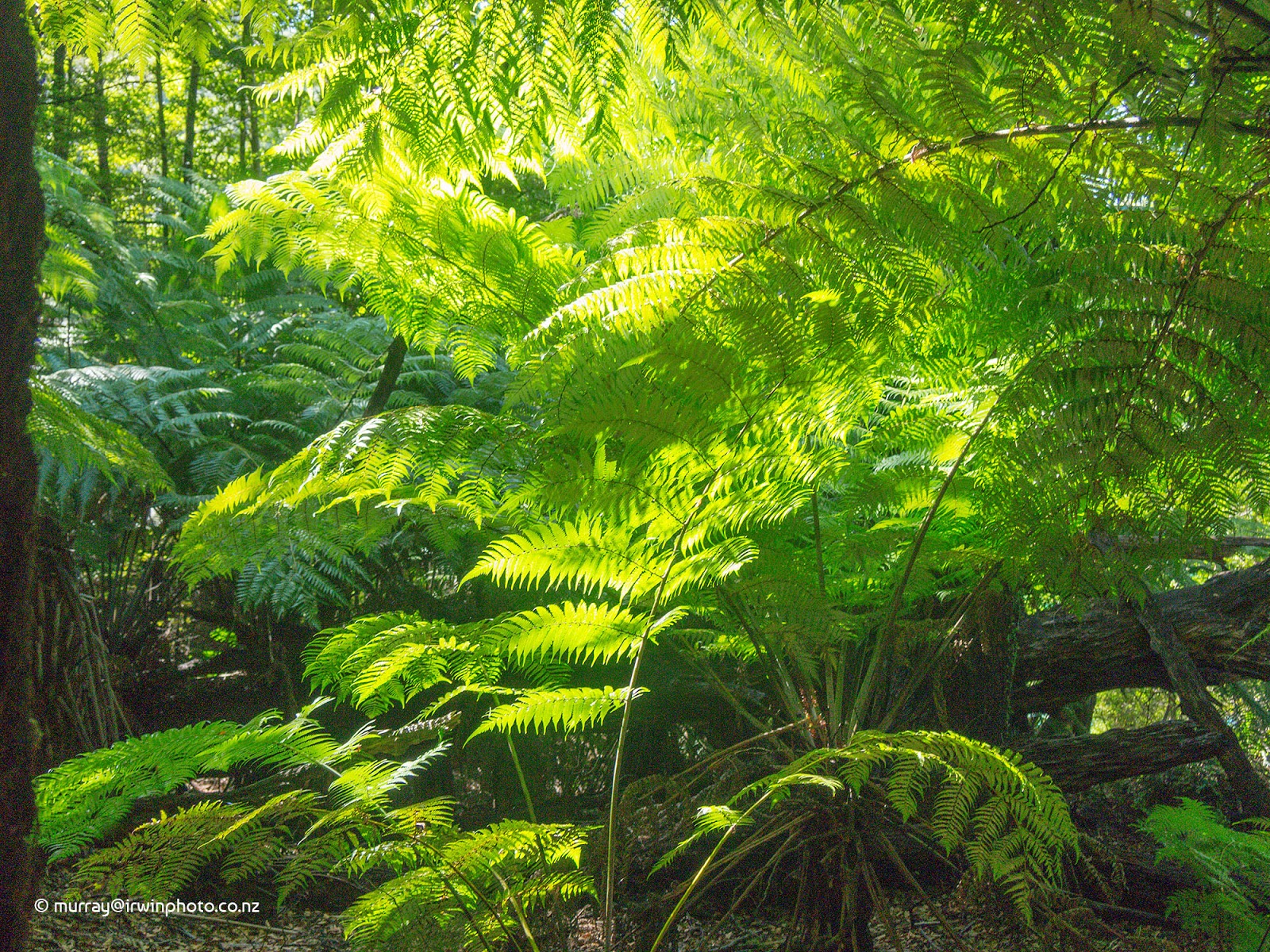
Other highlights included visiting a Gannet colony in Waimaru Bay which we had walked to look at from a distance five days ago and walking to Jacobs Bay through the Dillon Bell Point conservation reserve. The plentiful lush Punga Ferns were very impressive along this walkway.


It was interesting to return to Waimaru Bay by boat and look ashore to where we had spent two days camping last week.

A superb day out on the Sounds and well worthwhile.

After getting ashore we hurried ourselves to head back to Canvastown and up the Wakamarina valley to Butchers Flat DOC campsite for the night.
Day thirty eight.
Butchers Flat campsite is situated atop of high cliffs above the Wakamarina Gorge and was the site of one of the many goldmining settlements established along the river. The river and the surrounding hills covered in native bush, are beautiful.


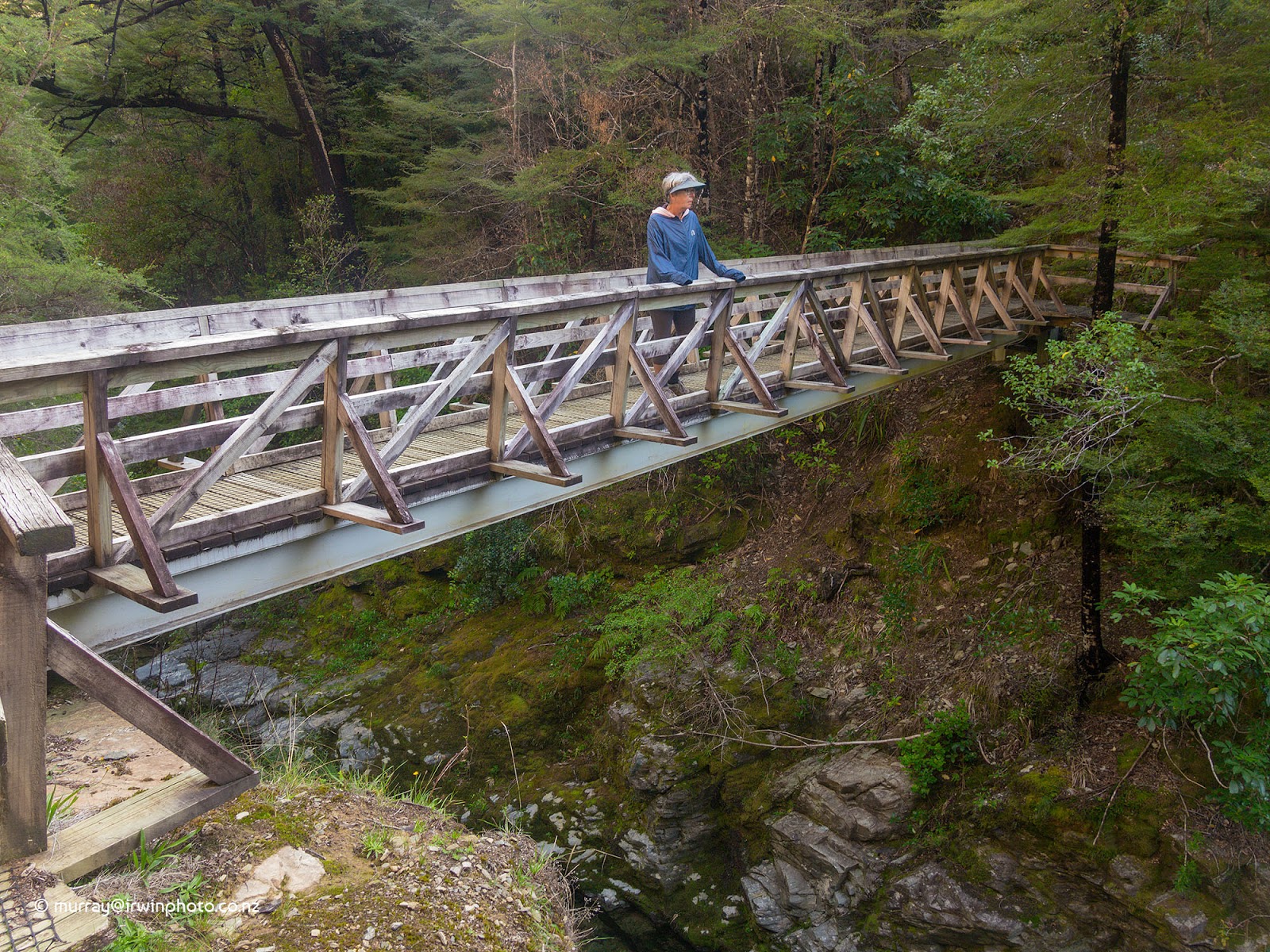
We took a two hour walk along the Wakamarina Track which is an old goldminers track connecting the Wairau Valley with the Wakamarina Valley, crossing a high bridge over Doom Creek along the way. With names like Doom Creek, Devils Creek and Dead Horse Creek you could feel you were part of a Hollywood western.


Returning to Canvastown we headed West toward Rai Valley and from there back to the outer Pelorus sounds and Elaine Bay DOC campsite for the night.
Day thirty nine.
Another colourful dawn signalling a fine day of clear skies and light winds.


Our destination today was French Pass, a place that holds some mystique for us and to which we have never been. After travelling twenty two kilometres along a narrow winding road high up on the ridgelines with spectacular views over the sounds and Tasman Bay we arrived at French Pass DOC campsite where we had a beach front camp site booked.


We were not disappointed. French Pass is beautiful and probably our favourite location in the Pelorus Sound waterways so far. Definitely a must see.

French Pass is best known for the massive tidal currents that pass between this part of the mainland and D'Urville Island which are five hundred metres apart at this point. With a tidal range of over four metres, currents of up to eight knots are normal, making navigation of the safe channel of only one hundred metres width, hazardous. Our afternoon walk took us to several look out points to observe the tidal flow racing from south to north across the treacherous reefs.


French Pass is also the departure point for passengers, vehicles and freight on the ferry bound for D'Urville Island.

Day forty.
Remained at French Pass today on another wonderfully fine day which got better as the day progressed.

The mission for today was to catch dinner which was proving difficult from our inflatable dinghy with deep water below and wind blowing on the surface. Catching Blue Cod wasn't too difficult but catching one above the legal minimum size limit was. That was until some friendly fellow campers, Liz and Dave from Cheviot, took us out in their boat fishing for a while. Fresh Snapper for dinner this evening and fresh Blue Cod for dinner tomorrow evening. Thanks.

Day forty one.
One last breath taking sunrise before we departed French Pass.


Despite enjoying French Pass immensely, we decided not to stay an extra night as strong winds were forecast and we did not wish to travel the high exposed access road along the ridgelines in those conditions.

Although we took the time as we left to view the tidal flow moving in the opposite direction through the Pass. It wasn't as impressive as our previous viewing, but fascinating none the less.

Retracing our outward journey, we returned to Elaine Bay campsite, where we took the bush walk to Piwakawaka Bay which was deserted and very tranquil.


Returning an hour and a half later hot and feeling like a swim I made my way to the end of the Elaine Bay jetty.

As evening came the wind strenghthened and became gusty shaking our motorhome through the night.
Day forty two.
After a night of gusty wind shaking our motor home we departed from Elaine Bay looking for calmer conditions. We had considered staying at Okiwi Bay. But after a brief walk on the beach in a cool wind, we decided to push on (although we will return to explore this lovely bay) and a short while later we parked at Brown River Reserve on the banks of the Rai River.


Day forty three.
Moved from Rai Valley to Cable Bay campsite, our last night before arriving in Nelson.
Day forty four.
Walked on the boulder bank at Cable Bay, a natural gravel and boulder causeway connecting the mainland with Pepin Island creating a tidal lagoon behind it. We had planned to walk some of the hill tracks but these were closed for aerial topdressing. This was also the case at Glenduan so our efforts to walk the hills at these two locations were thwarted so we moved on to Nelson to see friends.


Day forty five.
We will be doing limited updates while we are in Nelson but will report anything of interest over the next week.
Our travelling garden is still providing fresh salad after six weeks on the road.

Day forty six.
Another day in Nelson with our friends John and Di.
Dusted off our push bikes today or should I say evicted the spiders. Obviously our bicycles have had little use on this road trip. Travelled to Rough Island near Rabbit Island for a ride about the recreation reserve with our host, his dogs and family. Great to get out for some exercise.


Day forty seven.
Started the day walking with John and his dogs on Tahunanui beach as the sun rose.


The weather today was beautiful with stunning views across Tasman Bay.


Took a trip up the Maitai River valley with John to the Maitai dam and reservoir, which provides water for the city of Nelson. The river is very pleasant with walking tracks and MTB tracks in abundance. Another great day.


Day forty eight.
The COVID-19 Corona virus situation has been developing on a daily basis here in New Zealand. With the increasing prospect of domestic travel restrictions to contain it's spread we have resolved that we can no longer continue our journey. Consequently today we will be turning south, bound for Christchurch and home.
Day forty nine.
24/03/2020
Our retreat was hastened yesterday by the announcement that New Zealand will be placed in total Lock Down in two days in a concerted effort to stop the spread of COVID-19 Corona virus. We travelled as far as Marble Hill DOC campsite last night, which we visited on our outward bound journey on day ten of February's Blog.

Before leaving this morning I went to observe another interesting feature at this location. Back in 1964 a group of scientists built a twenty four metre long concrete wall across the surface of the main South Island alpine fault line. They did this to see if they could observe and measure slow creep in the fault over time. Nearly sixty years later and there is no evidence of fault line creep so it is theorised that the fault makes sudden large movements at large time intervals averaging three hundred and thirty years. The fault line surface rupture can be seen as a long low bank crossing the meadow and passing beneath the wall. It is a reminder of the massive natural forces generated by the movement of the earths crust which periodically have a major influence on our lives.


Now we must go home to face another natural occurence having a major influence on our lives caused by something so small we can't see it.
As we leave this stunning alpine valley we are reminded how lucky we are to live in the most beautiful country on the planet.


Thank you for this beautiful representation of our country in this record of your travels
ReplyDelete