
Day twenty two.
A morning walk to get the day started taking in the local fishing boats, cribs and the Picnic Gully bush walk.


Departed Taieri Mouth and headed for Toko Mouth at the mouth of the Tokomairiro river by way of some dusty and rough back roads. This crib community appeared nice enough and would have been more appealing with the sun shining and no cold wind blowing along the beach.

Our journey continued in sight of the ocean along more gravel roads and through several small communities. When the sun shone, so to did this beautiful coastline.

We eventually encountered the Clutha river and followed it upstream through Kaitangata and Balclutha to the small settlement of Tuapeka Mouth. Once we had parked our motorhome at the Tuapeka Mouth Heritage Hub we walked to the Tuapeka Mouth Ferry
This Punt is claimed to be the only remaining water driven public punt in the southern hemisphere. Not an engine to be seen anywhere, this ferry moves, almost mysteriously, by the power of the Clutha River. It is part of the New Zealand public roading system and transports foot passengers and vehicles across the Clutha River for four hours every day, 8:00 to 10:00 am and 4:00 to 6:00 pm. Naturally we made the return trip and enjoyed every second of it.


Day twenty three.


A nice 3 1/2 pound Brown Trout in great condition with lovely markings, it went back to live another day.
On the road again and after some provisioning we reached our stopping point for the night, Port Molyneux, Kaka Point. Once a thriving port town at the mouth of the Clutha River, it is now just farmland due to the river changing course in the late 1870s to enter the ocean some four or five kilometres to the north.

Day twenty four.


Departed Taieri Mouth and headed for Toko Mouth at the mouth of the Tokomairiro river by way of some dusty and rough back roads. This crib community appeared nice enough and would have been more appealing with the sun shining and no cold wind blowing along the beach.

Our journey continued in sight of the ocean along more gravel roads and through several small communities. When the sun shone, so to did this beautiful coastline.

We eventually encountered the Clutha river and followed it upstream through Kaitangata and Balclutha to the small settlement of Tuapeka Mouth. Once we had parked our motorhome at the Tuapeka Mouth Heritage Hub we walked to the Tuapeka Mouth Ferry
This Punt is claimed to be the only remaining water driven public punt in the southern hemisphere. Not an engine to be seen anywhere, this ferry moves, almost mysteriously, by the power of the Clutha River. It is part of the New Zealand public roading system and transports foot passengers and vehicles across the Clutha River for four hours every day, 8:00 to 10:00 am and 4:00 to 6:00 pm. Naturally we made the return trip and enjoyed every second of it.


Day twenty three.
That punt was so cool that we went back this morning for another trip across the river and back. And guess what, it's free!
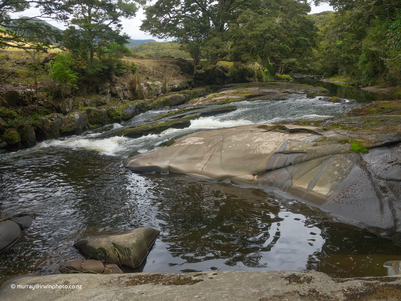
Next activity for the day was the Tuapeka River dam track which leads to relics of an early 20th century gold sluicing operation. Great little walk across open country beside the Tuapeka River.
Next activity for the day was the Tuapeka River dam track which leads to relics of an early 20th century gold sluicing operation. Great little walk across open country beside the Tuapeka River.


Walking by a river, no harm in taking a fishing rod, is there?


A nice 3 1/2 pound Brown Trout in great condition with lovely markings, it went back to live another day.
On the road again and after some provisioning we reached our stopping point for the night, Port Molyneux, Kaka Point. Once a thriving port town at the mouth of the Clutha River, it is now just farmland due to the river changing course in the late 1870s to enter the ocean some four or five kilometres to the north.

Day twenty four.
Into the Catlins Coast starting with Nugget Point Lighthouse and rocky islands from which the name 'The Nuggets' arises. This is a place with a special feeling perched on a precipice high above the Southern Ocean, all the better for the perfect weather on a near windless day.


Having met up with Sara's sister Kate and her partner Russell who are on an extended tour also, with their caravan, we moved on to our next activity. Tunnel Hill Walkway follows the old Catlins River Railway to a disused rail tunnel, 250 metres long. An easy, interesting short walk.

Lost a hubcap from your car? I think I know where it might be.


More Sea Lions sunning themselves on the Beach at Jacks Bay.


Day twenty five.


Having met up with Sara's sister Kate and her partner Russell who are on an extended tour also, with their caravan, we moved on to our next activity. Tunnel Hill Walkway follows the old Catlins River Railway to a disused rail tunnel, 250 metres long. An easy, interesting short walk.


Surat Bay and the mouth of Catlins Lake, which appears to actually be an estuary was where we encountered a large Sea Lion hauled up on the beach.


Jacks Blowhole is a collapsed sea cave which has formed a surge pool into which the ocean waves come and go. 200 metres inland, 55 metres deep, 144 metres long and 68 metres wide, it is well worth the effort of the walk to access it with dramatic coastal views.


Final destination for the day was Pounawea to spend the evening with Kate and Russell. We passed an old scow parked in the Owaka River on our way.

Had a quieter day today travelling up the Catlins River Valley to Tawanui campsite. From here we walked a short part of the Catlins River Walk. This section of the river is very picturesque and well worth the long drive up a dusty road. The campsite run by DOC is extensive and quiet, surrounded by native and exotic forest.


Day twenty seven.


Day twenty six.
The essence of The Catlins, waterfalls and beaches today and tomorrow.
Horseshoe Falls.

Matai Falls.

Purakaunui Falls.

Our destination for the night was Purakaunui Bay campsite, another DOC camp at a beautiful location.


And to finish the day, a Yellow Eyed Penguin. The worlds rarest Penguin species. This one in moult.


Day twenty seven.
Waking up early is not without it's rewards.


More beaches and waterfalls starting with a bush and beach walk to Cathedral Caves which must be visited at low tide.


Another bush and beach walk to Tautuku Bay. Native forest right to the beach head and no one else in sight.


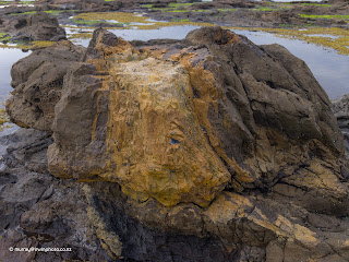
Day twenty eight.First destination on the list today was Curio Bay and particularly the fossil forest there. This area of petrified tree stumps, trunks and branches extends for 20 kilometres along the coast but is most visible at Curio Bay during low tide. Caused by successive severe floods containing volcanic ash burying the forest during the Jurassic Period around 170 million years ago. Stumps, fallen trunks and branches are all clearly visible but turned to stone. It is one of the most extensive and best preserved examples of it's type in the world.


Had to visit Slope Point, the southern most point on mainland New Zealand.


From there we retreated back up the Hollyford valley to Marian Creek which cascades impressively down from Lake Marian.


The view from our window.


More beaches and waterfalls starting with a bush and beach walk to Cathedral Caves which must be visited at low tide.


Another bush and beach walk to Tautuku Bay. Native forest right to the beach head and no one else in sight.


McLean Falls and series of cascades.


Final stop for the night, Niagara and the Niagara Falls, so named by a surveyor with a sense of humour having recently returned from the water falls of the same name on the Canadian USA border.

Day twenty eight.First destination on the list today was Curio Bay and particularly the fossil forest there. This area of petrified tree stumps, trunks and branches extends for 20 kilometres along the coast but is most visible at Curio Bay during low tide. Caused by successive severe floods containing volcanic ash burying the forest during the Jurassic Period around 170 million years ago. Stumps, fallen trunks and branches are all clearly visible but turned to stone. It is one of the most extensive and best preserved examples of it's type in the world.


Had to visit Slope Point, the southern most point on mainland New Zealand.


Our visit to Waipapa Point lighthouse coincided with the arrival of driving rain and a gale sou'wester which was blowing so hard our motorhome was shaking violently raising our concerns that we could be blown over. Fortunately after reparking facing into the wind the gusts eased and we were able to venture out to view the ocean which was decidedly less rough than when we arrived. Still, it was a reminder of the conditions that lead to this being the site of New Zealands worst civilian maritime disaster in 1881 when the ship Tararua foudered on reefs off Waipapa Point with the loss of 131 lives.


Day twenty nine.
After having spent the night at Otatara Beach Camp Invercargill the rain and wind had cleared to a fine cool morning. Today was a day of regrouping and planning ahead. Washing, groceries, rubbish, recycling, water and waste tanks. Following an enjoyable lunch at Zookeepers Cafe we set course for Riverton where after a drive out to The Rocks we parked for the night at the Riverton Golf Club. The view out to Foveaux Strait and Stewart Island from Howells Point was remarkable for the calm virtually windless sea, although the ever present southerly swells continually swept the rocks and beaches. The novel corrugated iron sofa looked more comfortable than it was but it was still cool.


Day thirty.
Had a look at the history displays beside the old port of Riverton on the Jacobs River estuary before we departed. One of New Zealand's oldest towns and once a busy Customs clearance and timber port, it is now a quiet seaside fishing town but surprisingly larger than either of us recollect.


We were headed west across Te Waewae Bay, checking out Colac Bay, Monkey Island and Gemstone Beach along the way. Te Waewae Bay is a rugged windswept bay at the base of the South Island constantly pounded by large breaking swells from the Southern Ocean. Well out to sea we were able to see Albatross' soaring on the waves while Dolphins surfed on the swells.

After passing through Tuatapere, the self proclaimed 'Sausage Capital' of New Zealand, our sights were set on Lake Hauroko. Ironically, Tuatapere doesn't appear to have had a sausage maker since 2015 when the butcher retired.
Lake Hauroko reaches deep into Fiordland and at 462 metres is New Zealand's deepest lake. It is very pretty, but access without a boat is very limited. Unfortunately for us the weather was overcast and drizzling, but we have visited before and it is, afterall, in a rain forest.

Day thirty one.
A drizzly start to the day made our decision to move on easy. So after a short walk in the bush, which is best seen in the rain, we headed for Lake Monowai.


On our way to our next stopover we took time to view and walk across the historic Clifden suspension bridge, completed in 1899. Now only open to foot and bicycle traffic.


Lake Monowai was dammed at it's outfall for power generation in 1925 which flooded it's margins, resulting in unsightly dead trees surrounding the lake. After nearly one hundred years the visual impact has reduced to the level that we found it almost unnoticeable and more appealing than Lake Hauroko. Extending deep into Fiordland also, this lake is very attractive viewed from the lookout at the end of a peninsula, fifteen minutes walk each way through native Beech forest.


We were treated to dramatic last rays of sunlight and a beautiful sunset over the lake.


Day thirty two.
Nothing much to report today. Moved from Lake Monowai to Te Anau, only stopping for a one hour walk along the lake shore at Lake Manapouri. Tomorrow we plan to start heading up the Eglinton and Hollyford valleys so won't be able to update this blog for about 5 - 6 days.
Catch you then.
Lake Te Anau, as beautiful as usual.


Day thirty three.
Top of the priority list today was to get our push bikes off the back of the motorhome to tackle part of the 'Lake 2 Lake' bike trail. This bicycle trail follows the southern shore of Lake Te Anau, then alongside the Upper Waiau River to Lake Manapouri's eastern shore to finish at Manapouri village. We rode to about the middle of the Waiau River section before returning to Te Anau, a distance of about 20 kilometres in total. This trail was spectacular, particularly the river section. At about 28 kilometres from end to end, it is not fully complete yet with some sections on public roads.
A quick refuel then we were on our way to Henry Creek campsite for the night before heading up the Eglinton Valley. Henry Creek DOC campsite is situated on the eastern shore of Lake Te Anau and gives easy access to the beach from where great views of Middle Fiord can be had. I took a quick swim in the lake but Sara was too slow with the camera. We enjoyed yet another lovely sunset on the beach and returned at 11 pm to experience the stars of the Great Southern Sky across the lake, which happened to be perfect timing for moonset.


Day thirty four.
Today was a short move to Walker Creek DOC campsite in the Eglinton Valley. Fishing was the order of the afternoon but sadly, nothing to report there. Just being able to be fishing in such stunning scenery is reward enough.
Day thirty five.
From Walker Creek we moved further up the Eglinton Valley while doing a reconnaissance of the other campsites available. Cascade Creek campsite was our final stopping point for the night which is situated within 15 minutes walk of Lake Gunn along a nature trail bush walk through many majestic Red Beech trees with Kaka amongst the many birds in the canopy. Fishing in Lake Gunn during the late afternoon produced a 2 3/4 pound Rainbow Trout in fine condition and after a very spirited fight it was returned to the lake. Sara was on camera duty again at the lake where she got friendly with one of the many South Island Tomtits.


Day thirty six.
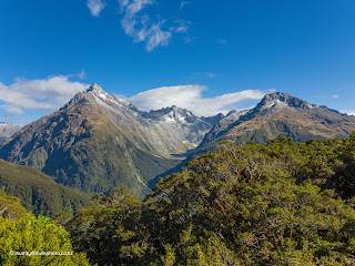
Awakening to a clear, still day we made an early start heading for The Divide, where we parked our motorhome, donned our tramping boots and set out on the climb to Key Summit. This three hour return hike follows part of the Routeburn Track and climbs about 450 metres to a lookout with all round views of the surrounding mountains and valleys. Dominated by the Darran and Humboldt mountain ranges, and the Hollyford Valley, the vista is breathtaking. Absolutely magnificent, this is a must do.


After returning from Key Summit, we carried on down the Hollyford Valley to Gunn's Camp, a 1930's roadworks camp that has been converted to a motor camp and using the old cabins for accommodation. Very rustic with bush walks and it's own museum, this is a great place to stay in a beautiful location.


Day thirty seven.
We carried on down the Hollyford Valley through the ancient temperate rain forest for which Fiordland is renowned, alongside the wild and beautiful Hollyford river.


The end of the road is the starting point of the Hollyford Track but we were here to see the Humboldt Falls, 275 metres high.

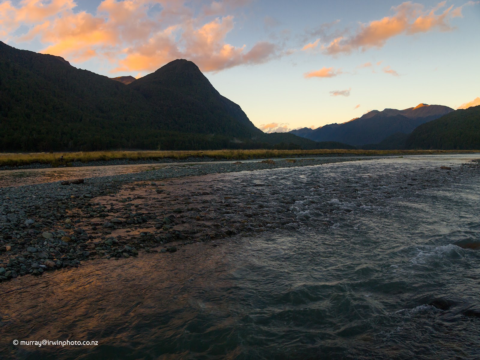
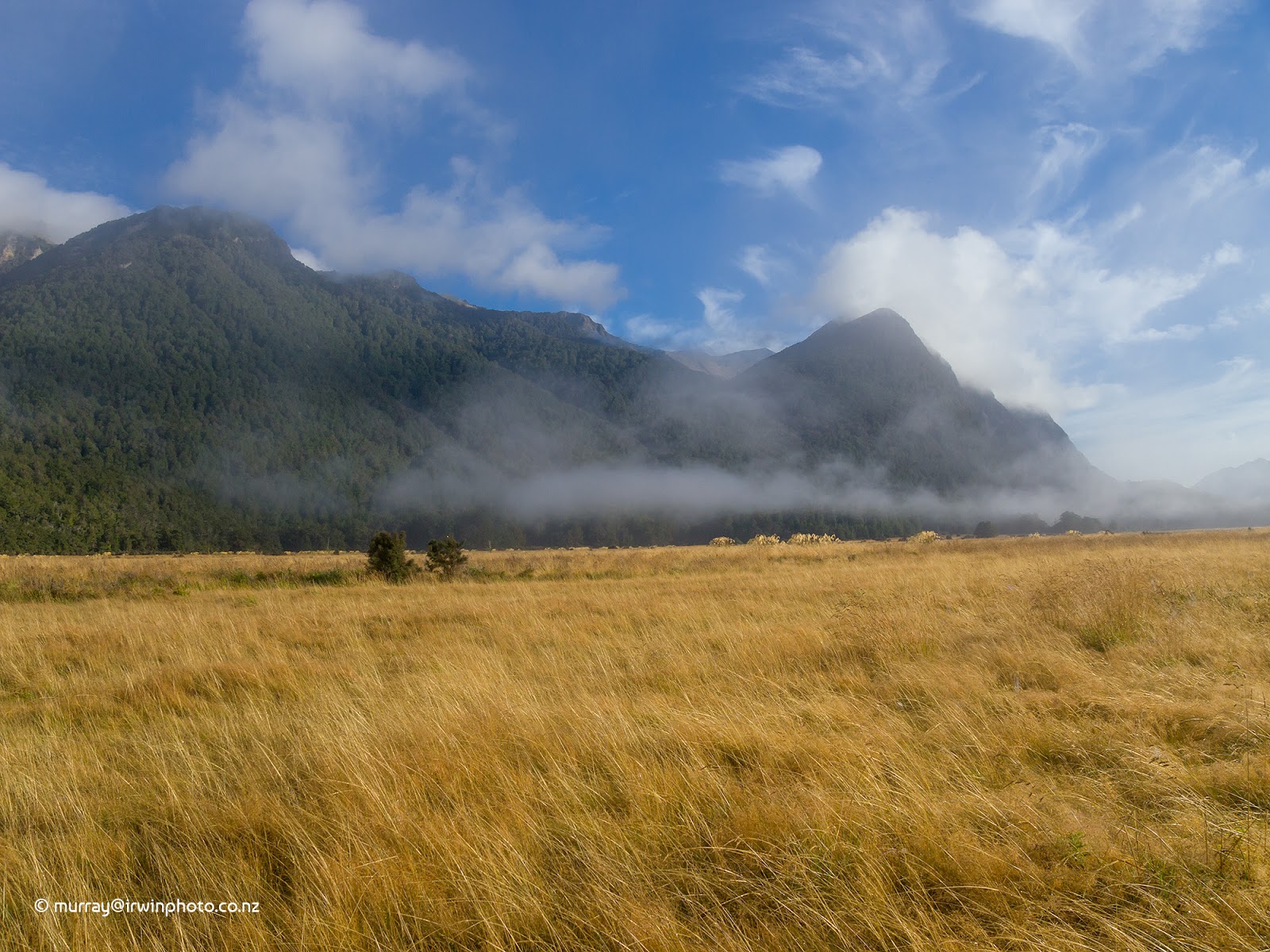
From there we retreated back up the Hollyford valley to Marian Creek which cascades impressively down from Lake Marian.

From here we returned to the Eglinton valley and Deer Flat DOC campsite for the night.
Day thirty eight.
Departed Deer Flat bound for Te Anau and a day catching up on chores and administrivia after five days in the wilderness. Stopped briefly at Mirror Lakes on our way and although there was low cloud the lakes were calm and picturesque.
Our backyard at Deer Flat.


Day thirty nine.
All reprovisioned and everything sorted out we left Te Anau behind, but not before pies for lunch from 'Miles Better Pies' by the lakeside. The pies absolutely live up to their name, primo! 8.5/10
Proceeding east, we turned left at The Key and travelled nearly forty arduous kilometres along extremely dusty and rough gravel roads to Mavora Lakes. We stayed the night at the southern end of North Mavora Lake, the remaining nine kilometres to the northern end only being accessable by four wheel drive vehicles.
Still being blessed with fabulous weather we saw these lakes at their best. None the less they are simply serene and gorgeous.

The view from our window.

Day forty.
Another day at Mavora Lakes relaxing, walking, reading and fishing in this beautiful back country area. This afternoon we retreated back to the much smaller South Mavora Lake, possibly more magical than North Mavora with our own private beach. We finished off the day with a camp fire in the great facilities provided by DOC.


Day forty one.
After crossing the swing bridge at the lake outlet for a walk and sad to leave Mavora Lakes, we headed for Lumsden and reconnection with the rest of the world prior to disappearing into the back country again.


Day forty two.
Left Lumsden bound eventually for Piano flat, stopping along the way to fish for trout in the world famous Mataura River. Piano Flat was the site of historical gold mining and timber milling operations but is now a well maintained DOC campsite on the banks of the Waikaia River nestled in the hill country of northern Southland. Large grassed areas and facilities set beside the river among a mature Beech forest make this an ideal base for many activities including tramping, mountain biking, four wheel driving and fishing. Sara got really brave and crossed the long and high swing bridge leading to one of the several walks available.


Day forty three.
Spent the day at Piano Flat riding our mountain bikes, fishing and walked the Ngahere Ara short track which passes several relics of the gold mining past including disused mine shafts and a working water race that supplied water for gold sluicing. This is a very pleasant campsite but the sand flies can be ferocious.


Day forty four.
Sorry to leave our position at Piano Flat looking out across the Waikaia River, but not the sandflies. Saturday today and we are starting to move slowly towards Invercargill so we can get a new Certificate of Fitness for our motorhome, on Monday. We got as far as Mandeville Ponds after visiting Waikaia township to view the bottlehouse made of 20,000 glass wine bottles which is attached to Switzers Museum. Mandeville Ponds was a pleasant enough place to stay for the night.


Day forty five.
Moved closer to Invercargill today passing through Gore, Mataura and Edendale (the home of New Zealands oldest cheese factory opened in 1895) to park for the night at Seaward Downs Scenic Reserve. A large grassed area surrounded by a lowland mixed native forest of about 50 hectares. There is a really nice 1.2 kilometre walking track through the forest with many very large trees, mainly Rimu, and prolific bird life including the tamest Fantails we have ever encountered. A quiet night on our own at an unexpectedly lovely location.


Day forty six.
Into Invercargill early to get to the vehicle testing station but still had a three hour wait. Finally got our Certificate of Fitness inspection completed and failed unfortunately. Some mechanical work needed and booked in for repair on Thursday. Ah well. A bit of shopping and reprovisioning done, we headed for a campground at Lorneville just outside Invercargill to carry on with domestic chores.
Day forty seven.
Just marking time today while we waited for Thursday so we can get back on the road. Did a spot of fishing in the Aparima River which was full of fish, and still is sadly. Did a late drive to Lumsden for the night to be ready for a couple of farm visits in the morning.
Day forty eight.
Visited two dairy farms in the Lumsden area today which was very interesting.
Travelled back to Riverton to be close to Invercargill for an early morning appointment with the truck mechanics.


Day forty nine.
A large dollop of money changed hands today for the repairs to our motorhome and we were issued with a renewed Certificate of Fitness. Hooray, back on the road again.
We treated ourselves to a lunch of Fish n' Chips for the first time in over a month. Purchased from Kings Fish Market and claimed by some to be the best in Southland, they were very good and certainly 8/10. We left Invercargill mid afternoon headed in the direction of Queenstown and beyond. Our final stopping place for the night was Fairlight on he banks of the Upper Mataura River. Fairlight Station is on the old disused Lumsden to Kingston railway line on which the Kingston Flyer used to run.


Day fifty.
We crossed back into Otago again today on our way to Kingston where we observed the former Kingston railway station, now a Cafe and Bar. We were disappointed to see the Kingston Flyer locomotive, once the pride of Kingston, mothballed and deteriorating in a railway yard. Onwards along the shores of Lake Wakatipu. We couldn't get out of Queenstown fast enough with the bustle and congestion spoiling the beauty of the place for us. Continuing along the shore of Lake Wakatipu which was picture postcard calm and glistening we passed through Glenorchy to reach our destination of Kinloch at the head of the lake. Here there was clear evidence everywhere of the flooding caused by the torrential rain of three days ago with the Dart River still in high flow with muddy water and large flotsum rafts on the lake.


Day fifty one.
Another fine day and plenty planned for today. We have been incredibly lucky with the weather so far.
We had a last look around Kinloch and the campsite at the mouth of the Dart River before heading to the eastern end of the Routeburn Track. Our aim was to walk about an hour along the track through the lush Beech rainforest before returning. This got us as far as Forge Flat, a historic Blacksmiths camp, through the sheer rock faces of Route Burn Gorge, towering high above us and descending deep into the gorge below us. Truly magnificent. Along the way we encountered several Rifleman birds and two pairs of Whio, Blue Ducks. Both ends of the Routeburn track taken care of now, just the small matter of the three days in between to attend to.


From the Routeburn Shelter we proceeded to Lake Sylvan Campsite where we walked the one hour return track to the lake formed behind old glacial moraine. Lake Sylvan Campsite is a DOC campsite exceptionally tidy and well maintained and this was our stop for the night.

Day fifty two.
A warm start to the day as the sun lit up Mount Ernslaw and the Dart River valley.


After a busy day yesterday we were planning on less strenuous activities today, starting with the Diamond Creek walk to Reid Lake.

Following this we went to Paradise then finally Diamond Lake for a lazy afternoon and evening.


Even old trucks want to go to Paradise when they die.


Wow! Amazing retirement trip. It was lovely to see your Catlins Pictures, a small reminder of our trip with you through there. Keep on trucking. XX Karen
ReplyDelete