The Adventure Resumes North Island New Zealand October 2023

Today is the first day of September, officially the beginning of Spring 2023 in New Zealand and the weather is certainly improving. Our plan for this Summer is to travel extensively throughout the North Island. We will be crossing Cook Strait from Picton to Wellington at the end of September. Check back here early in October to continue our adventure with us.

In  the meantime you could follow our South Island adventure from the beginning in 2019 in our Archive.


04/10/2023

The Adventure October 2023

In March 2020, while on our tour of the top half of the South Island, our progress was halted by the arrival of COVID - 19 into New Zealand. Our plans to travel the length and bredth of the North Island in 2021 were disrupted by the ongoing pandemic management and family matters. But now, three years later, we are ready to tackle the North Island.

Our chosen starting point for our blog of this long journey was Cape Palliser, the southern most tip of the North Island, which just seemed logical to both of us. This rugged, rocky promontory marks the  eastern entrance to Cook Strait with a tall lighthouse perched high upon a narrow rocky point.
The Cape Palliser Lighthouse is an eighteen metre high cast iron tower and first shone it's warning to mariners in 1897. To reach the lighthouse one has to climb 252 exhausting steps, but it is well worth the effort for the spectacular views.


Cape Palliser supports a large colony of New Zealand Fur Seals, with large numbers of pups waiting for their mothers to return from the sea with food.


Four kilometres west of Cape Palliser is the fishing village of Ngawi. There is no harbour or boat launching ramp here, so the fishing boats are launched straight off the beach into the surf using tracked bulldozers. This large collection of old bulldozers sit at the beach head rusting in this harsh marine environment for the single purpose of launching fishing boats, until they cease to operate and become assigned to the scrap metal heap. 
The fishermen at Ngawi put to sea to harvest the delicacy of Crayfish. But as testament to the harsh sea conditions here, we were told this was the first day in three weeks that the fishing boats had been able to be launched.


Continuing on our way we reached Putangirua Pinnacles campsite run by the Department of Conservation, where we parked for the night. This campsite is the entry point for the walking tracks to the Putangirua Pinnacles Scenic Reserve. To round off an energetic day we took the 1.5 to 2 hour return walk to view the Pinnacles. These interesting land forms are created by erosion of the soft gravel hillsides, leaving pillars where erosion is suppressed by hard materials or bound by vegetation roots at their caps.


05/10/2023 - 08/10/2023

After leaving The Pinnacles we visited Martinborough on our way to four days spent in Southern Wairarapa walking and fishing, mainly close to Carterton. A night each at 'The Cliffs Reserve' and 'Gladstone Public Reserve'. Both pleasant free camping areas on the banks of the Ruamahanga River for Certified Self Contained campervans and motorhomes. Also on the Ruamahanga River, we spent a night at Morrisons Bush picnic and camping area. This extensive privately owned recreation area is made available to the public through the generosity of the owner. A spectacular burst of late evening sun rounded off the day superbly for us followed by a quiet and peaceful night.


For our last night in the Carterton area we stayed at the Department of Conservation Holdsworth Campsite. This is a large well maintained campsite and picnic area with extensive open grassed areas, offering several gorgeous short walks and is the main eastern entrance hto the tramping tracks of the Tararua Forest Park. Despite the overcast weather, our walk to 'Donnelly Flat' then up to the 'Rocky Lookout' platform was most enjoyable. The mature native trees and lush under growth were impressive but we particularly liked the 'Kidney Ferns' in their range of vivid greens.


Two shorter walks we took;

Fensham Reserve Circuit Track through mature and regenerating forest with a remnant of Kahikatea swamp forest. Taking about an hour to complete there are two lookout points at the top of this circuit.


Kahikatea Walk in the Carter Scenic Reserve, through recovering wetland and a remnant of flooded forest. This walk takes about half an hour and is mainly on boardwalks.


09/10/2023

After provisioning in Masterton we took the road to Riversdale Beach, some forty kilometres east of Masterton. Riversdale Beach is a popular seaside settlement boasting a golf course, tennis courts, fishing, swimming, surfing and walking on the four kilometre long sand beach.
It was developed in the 1950's by local surfer and champion swimmer, Basil Bodle, despite much skepticism from others. Riversdale Beach has proven to be a popular and successful development with 150 permanent residents and many holiday homes and baches.


The beautifully restored church St Josephs of Riversdale Beach started it's life in 1881 as St Josephs Roman Catholic church at Tinui, 32 kilometres away. One hundred years later in 1981 it was transported by truck to it's current location at the beach.
We were surprised at the size of this beachside settlement which we liked very much. The Fish and Chips shop is well worth a visit too.


10/10/2023

Our next destination was Castle Point, also on the East Coast of Wairarapa. Another popular holiday destination with a sandy beach, however, dominated from every angle by the 23 metre high cast iron Castle Point lighthouse, standing 52 metres above the ocean on a rocky promontory. The Castle Point lighthouse first shone 35 kilometres out to sea in 1913, intended to assist inbound international shipping from Panama to Wellington with safe landfall.


Beside visiting the lighthouse there are plenty of other activities one can do including swimming, surfing, fishing and walking on the beach or surrounding hills. If you have a head for heights you could climb to the top of Castle Rock, 162 metres above sea level.


11/10/2023

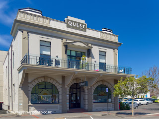
As we were about to leave the provence behind we had to admit that our impressions of Wairarapa had changed considerably for the better. We noted the obvious civic pride of the residents with well maintained properties and facilities, particularly the many beautifully restored historic buildings in all the major towns. Wairarapa for us had a great feel and we could live there happily.


There is still the odd building awaiting a renovation back to it's former glory.


Back to the adventure. Our plan was to head to Te Paerahi ( Porangahau Beach) because it looked interesting. After refuelling at Masterton, the 160 kilometre trip along Route 52 had a duration of 2 hours and 37 minutes according to Google Maps. Our travelling time was closer to four and a half hours over narrow, winding and ever worsening roads, showing the cyclone damage inflicted earlier this year. State Highway 52 felt like we were driving in a long past era. On the stretch from Te Ore Ore to Pongaroa, a distance of 86 kilometres, we passed 13 vehicles travelling in the opposite direction and many fewer heading our way. After a much needed break and late lunch upon reaching Pongaroa, we continued, stopping at our parking place for the night late that afternoon.


For the Tennis enthusiasts among you, we  passed by the Wimbledon Tavern in Wimbledon. 


Shortly after that we came upon the place with the longest name in the world, according to The Guiness Book of World Records, at 85 letters. 


Te Paerahi ( Porangahau Beach), proved to be yet another lovely sandy beach 14 kilometres long, however less developed and populated. A quiet relaxing evening and night after a hectic day.


12/10/2023

Leaving Te Paerahi, we made our way through Waipukurau and Havelock North to ascend the sealed road to the summit car park of Te Mata Peak. This peak rises steeply to a maximum height of 399 metres, offering commanding views of Hawkes Bay, Napier, Hastings, Havelock North, the Tukituki Valley and in suitable conditions, Mount Ruapehu and the Mahia Peninsula. On it's western side steep grassland decends to Havelock North criss crossed by walking tracks and MTB trails, while on the eastern side huge cliffs drop into the Tukituki Valley. Te Mata Peak was gifted to the Public in 1927 as a park in perpetuity by the descendants of John Chambers who farmed Te Mata Peak from the 1850's. A great public asset.


Following our visit to Te Mata Peak we made our way to Clifton Road Reserve where we spent the afternoon enjoying the great weather at this beachside free camping area.

13/10/2023

A clear morning made for a colourful pre-dawn sky looking along the beach toward Cape Kidnappers.


Today we decided we needed a couple of quieter days to catch up on grocery shopping and chores, with a bit of sightseeing around Napier. After we had travelled into Napier we found a quiet public car park at Perfume Point on the foreshore to consult Google Maps. There we noticed five brightly coloured outdoor chairs, presumably sculptural, which appear quite normal at a small distance until you have a point of reference or scale. With Sara sitting on one it was obvious that these chairs were carefully proportioned copies, two to three times life size. Interesting the ways our eyes can be tricked.


Having consulted Google Maps we proceeded to the Napier Port lookout on Bluff Hill. From here it is obvious that this is a major logging port supporting the extensive forests of Pinus Radiata grown in the Napier and Gisborne regions. Major it is, with two and a half million tons of export logs crossing the wharves at Napier annually, making this the most significant timber port in New Zealand.


In the afternoon we walked on the Ahuriri Estuary loop track. 
Prior to the 1931 Napier earthquake the Ahuriri Lagoon covered around 4000 hectares, virtually surrounding Napier City. During the earthquake the land under the lagoon was uplifted 1.5 to 2 metres exposing parts of the seabed and reducing the area of the lagoon by about 3000 hectares. The Napier Airport is built on what was lagoon seabed, along with some of the Western suburbs. Ahuriri Estuary is now a sanctuary for wading birds.


14/10/2023

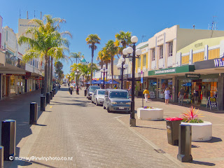
Strangely, despite the tragedy and destruction caused by the 1931 Napier Earthquake, it has become a defining factor in the cities identity. As mentioned before, the creation of land for the expanding suburbs of this growing city. Also the architectural style and character of the rebuilt city of Napier. At the time Napier was rebuilding, the Art Deco style of architecture was fashionable and popular. Consequently, large numbers of buildings and houses built in Napier at this time were created in this flambouyant style. We took a little time to walk through the city centre to photograph a few examples that caught our eyes.


15/10/2023

Today we continued our journey north to Lake Tutira where we parked for the night. Unfortunately the DOC campsite here was closed temporarily due to cyclone damage, which was disappointing as it is beautiful and tranquil.


16/10/2023 - 19/10/2023

Moving on to Wairoa, I stopped our motorhome in the middle of the Mohaka River bridge while Sara quickly photographed the impressive Mohaka River railway viaduct. This steel structure is part of the disused Napier to Gisborne railway line and with a length of 277 metres and a maximum height of 95 metres it is the tallest viaduct in Australasia.


After making a brief stop for last minute groceries in Wairoa we turned inland destined for Lake Waikaremoana, which held a bit of intrigue for me. So visiting Lake Waikaremoana was on my list of Must Do's on our North Island journey. Located about 60 kilometres northwest of Wairoa at an altitude of 580 metres above sea level and maximum depth of 220 metres, Lake Waikaremoana covers an area of 54 square kilometres within Te Urewera. Our first night was spent at Mokau Landing DOC campsite in Mokau Inlet completely on our own.


With no other campers, no cellphone service and no internet we enjoyed a very quiet and peaceful night. I say no cellphone or internet service as we have both on our motorhome through the Spark national cellphone network and the Rural Broadband network through provider Wireless Nation. Both systems deliver very different service coverage, often giving us no service on one but a strong signal on the other. In short, we are very seldom with no communication at all.
The following day we transferred back to Waikaremoana Holiday Park at Te Karetu Inlet, stopping on the way to look at the picturesque Mokau Falls.


After a hot shower and a good night sleep, we were ready to tackle the two and a half hour return, 310 metre climb up to Lake Waikareiti, after first visiting the Aniwaniwa Falls.


On arrival at our destination of Lake Waikareiti we were greeted by a fresh cool wind in our faces which hastened our departure and return to our vehicle.


Back on the dusty, winding, gravel road again, we made our way to our campsite for our last night, at Rosie Bay, where once again we were alone for the night. Rosie Bay is notable for the huge block like rock formations on the hills above.


Departing the next day after three lovely peaceful and relaxing days surrounded by beautiful native forest and bush, I have now satisfied my curiosity regarding Lake Waikaremoana.


While we were in the remote surroundings of Lake Waikaremoana our water pump stopped working. This made life a little awkward with no running water onboard our motorhome. However, after purchasing some dressmakers pins and a roadside fixit job in Wairoa we were on our way again to Oraka Beach on the Mahia Peninsula for the night, with running water again and time to get in an evening walk on the beach.


20/10/2023

An early start was required today as we had made a booking for an adventure on the Napier to Gisborne railway. Our pre-dawn roll out of bed was rewarded with a very colourful sky over Oraka Beach.


But no matter how much we liked Oraka and Mahia beaches, we had to depart for our rendezvous much closer to Gisborne. You can join us on our Railbike Adventure at our separate Railbike post.
Following our Railbike Adventure we made our way to Gisborne where we had a long walk on Midway Beach before settling in for a quiet evening.

22/10/2023

Starting in Gisborne today our journey over the next few days was going to take us through the East Cape area and into the Bay of Plenty. Gisborne is significant in the European history of New Zealand as the first place europeans set foot on New Zealand soil when Captain James Cook landed on Kaiti Beach in early October, 1769. A bronze statue close to the beach commemorates the first sighting of New Zealand from Cook's barque, HMS Endeavour, by the Surgeons Boy Nick Young at 2 pm on 7 October, 1769. The statue of Nick Young is pointing across Poverty Bay towards the white cliffs of the headland later named 'Young Nicks Head' by Captain Cook and known to the Maori as Te Kuri.


First stop along our way was Tolaga Bay and it's famous wharf which is closed to access. Completed in 1929, this wharf reaches 660 metres out into the deeper water of the bay which allowed large coastal trading ships to load and unload cargo. By 1968 when the wharf was closed, roading to the East Coast region had improved dramatically, allowing trucks to move the cargo previously shipped across the Tolaga Bay wharf. Ironically a large amount of this cargo was roading material which ultimately led to the demise of the wharf.


By chance we discovered an excellent walkway very close to the wharf. The Cooks Cove Walkway takes you across farmland to a lookout 120 metres above sea level then down through native regeneration bush to a small cove where Captain Cook anchored his ship Endeavour to replenish water and timber supplies in 1769. Also to be seen here are a commemorative monument and the 'Hole in the Wall' natural archway which was recorded in sketches by Cook's Botanist, Joseph Banks.


Our overnight stop was at Anaura Bay DOC campsite. Another great campsite adjacent to a splendid East Coast sweeping golden sand beach.


23/10/2023

Tokomaru Bay further north has a similar concrete wharf to Tolaga Bay but about half the length at 366 metres.


The current wharf was built in 1940 to replace an earlier structure and increase the amount of cargo that could be handled from the freezing works and wool store established at the landward end of the wharf between 1910 and 1911. The Tokomaru Bay Freezing Works  and wharf had a similarly short but successful operational life to the Tologa Bay wharf and suffered the same fate due to falling stock numbers, improved roading infrastructure and capabilities of trucks. Closing it's doors in 1953 after 42 years of service to the East Coast farming community and major employer for the Tokomaru Bay local community would have had a significant impact on the area. All that is left of this once thriving industrial complex is the decaying and crumbling buildings and wharf.


Continuing on our way towards Te Araroa, the roads were showing strong evidence of how severely they were damaged by the cyclones earlier this year, meaning a slow trip. We passed through Te Araroa on our way to the East Cape lighthouse. Unfortunately the access path was closed due to cyclone damage although we have visited the lighthouse before and made the claimed 800 steps to it. We were in the lighthouse car park, a mere 500 metres from the eastern most point on the New Zealand mainland with Whangaokeno / East Island laying 2 kilometres offshore.


It was a long day driving but we wanted to push on to Waihau Bay on the north side of East Cape for the night and arrived in time for a leisurely walk on the beach before relaxing for the night and reviewing our day.


24/10/2023

Grey sky and showers today. One short walk along the foreshore between showers. Otherwise catching up with photo processing and maintenence.

25/10/2023

More rain showers this morning but we continued on our way. This coastline is best viewed in sunny calm conditions. Blue ocean, blue sky, green grass and white surf but not today. A walk on the beach at Te Kaha Bay and a windy night spent at Maraenui with a roaring surf.


26/10/2023

More cloud and showers today as we pushed on towards Opotiki with White Island / Whakaari - New Zealand's most active volcano - just visible through the haze 48 kilometres out to sea with steam venting from it's crater.


After a long walk on Hikuwai Beach we changed our plan to spend the night at Opotiki or Whakatane and turned towards Rotorua where we had arranged to spend a few days with friends from the 27th. That night we spent at Lake Okareka DOC Camp in overcast drizzly weather before joining our friends the next day.


27/10/2023 - 30/10/2023

Time out from our life on the road we spent with our friends in Rotorua. We returned to Lake Okareka to take our inflatable canoe for a very pleasant paddle on the lake.


The weather was back to fine and sunny but was forecast to change to strong winds and heavy rain as ex-tropical cyclone Lola approached. Other activities we enjoyed with our friends were fishing at The Landing Lake Tarawera, walking the Lake Okareka Walkway, walking the Okere Falls Track and watching white water rafters dropping down the 7 metre high Tutea Falls on the Kaituna river.


And to finish off, what better after all that walking, than soaking our feet in a mini thermal hot tub at Secret Spot Cafe.


31/10/2023

Back on our journey again today but with a change of plan. Our intention for the next stage of our tour was to travel to and explore the Coromandel Peninsula. However, for the last two days the Coromandel Peninsula had been battered by Ex-Tropical Cyclone Lola, and continued to be so. Very heavy rain had fallen with extensive flooding and the risk of road closures due to slips and flooded roads. It was likely to be days or weeks before the peninsula dried out and returned to normal. So we turned ourselves west to the other side of the island where the weather had been more benign. Along the way a couple of activities had caught our eyes as we planned our new route. First up was the Te Waihou Walkway to the famous Blue Springs near Putaruru. Taking up to one hundred years to seep down from the Mamaku Ranges it is one of the purest water sources on the planet. The spring water flows at 42 cubic metres per minute and a constant 11 °C all year. Around 70 percent of New Zealands bottled water is sourced from the Blue Springs.


Before arriving at our overnight destination of Otorohanga we were to cross part of the Waikato river below the Arapuni hydro electric power station on foot. Stepping onto the Arapuni Suspension Bridge you are quickly aware that you are high above the power station and the swirling water discharging from the turbines. Built in 1925 to allow construction workers to cross the Waikato River to the dam and power house projects. This ninety eight year old, Class 2 Heritage structure, crosses the river with a single span of 152 metres and a maximum height of 54 metres above the river.


Popular Posts